
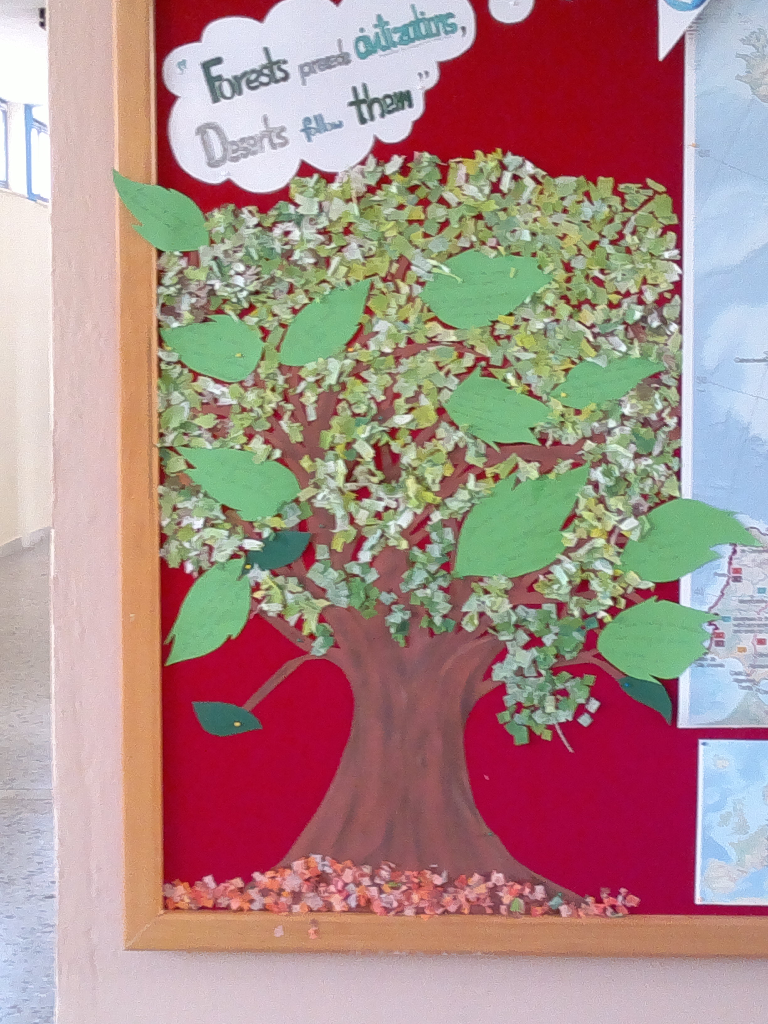
 Erasmus+ Corner
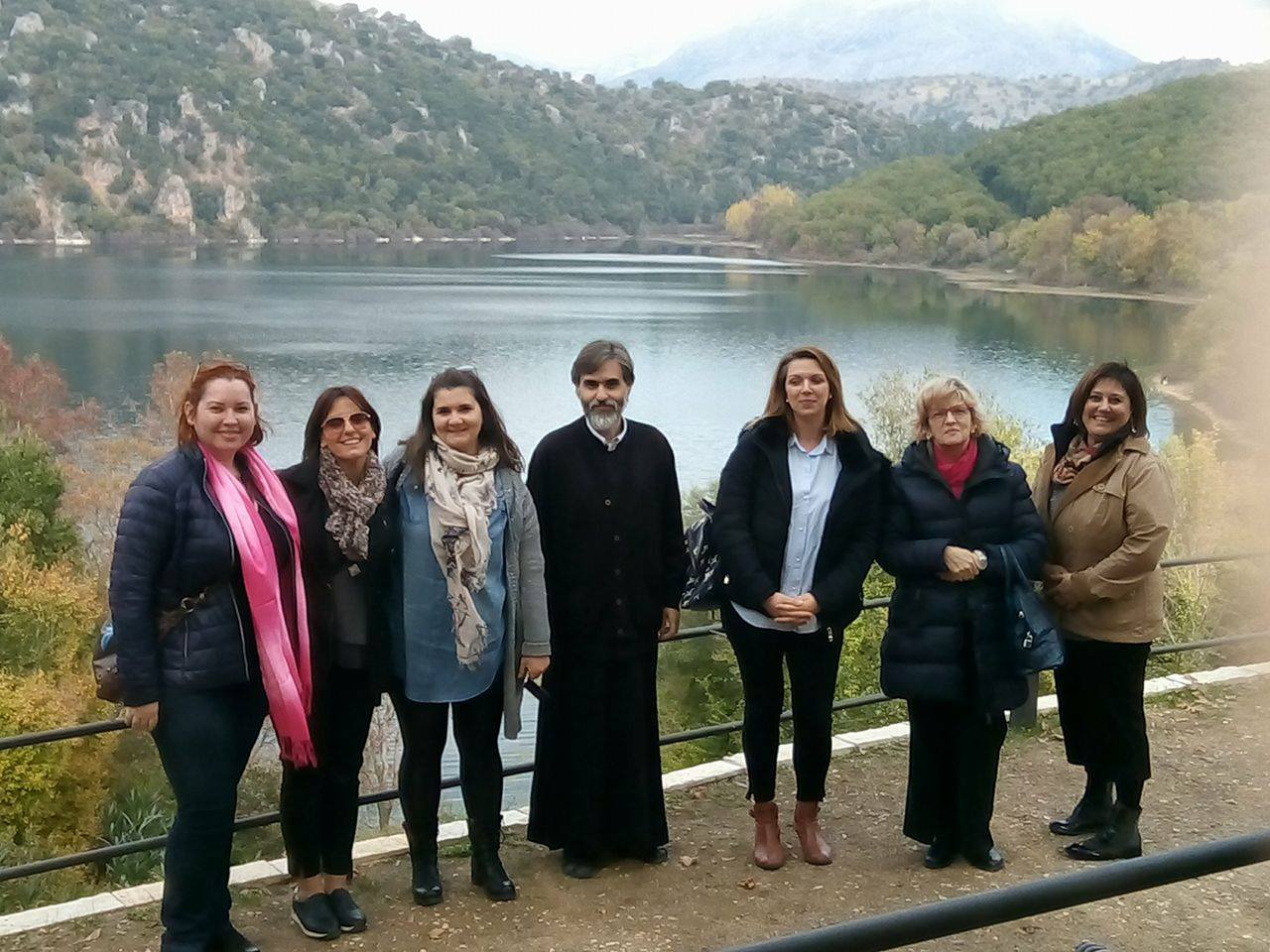 Transnational Meeting
 Library
 High School of Thesprotiko
 Caminiti Trimarchi
 Liceum Teoretic Aurel Lazar
  Thesprotiko
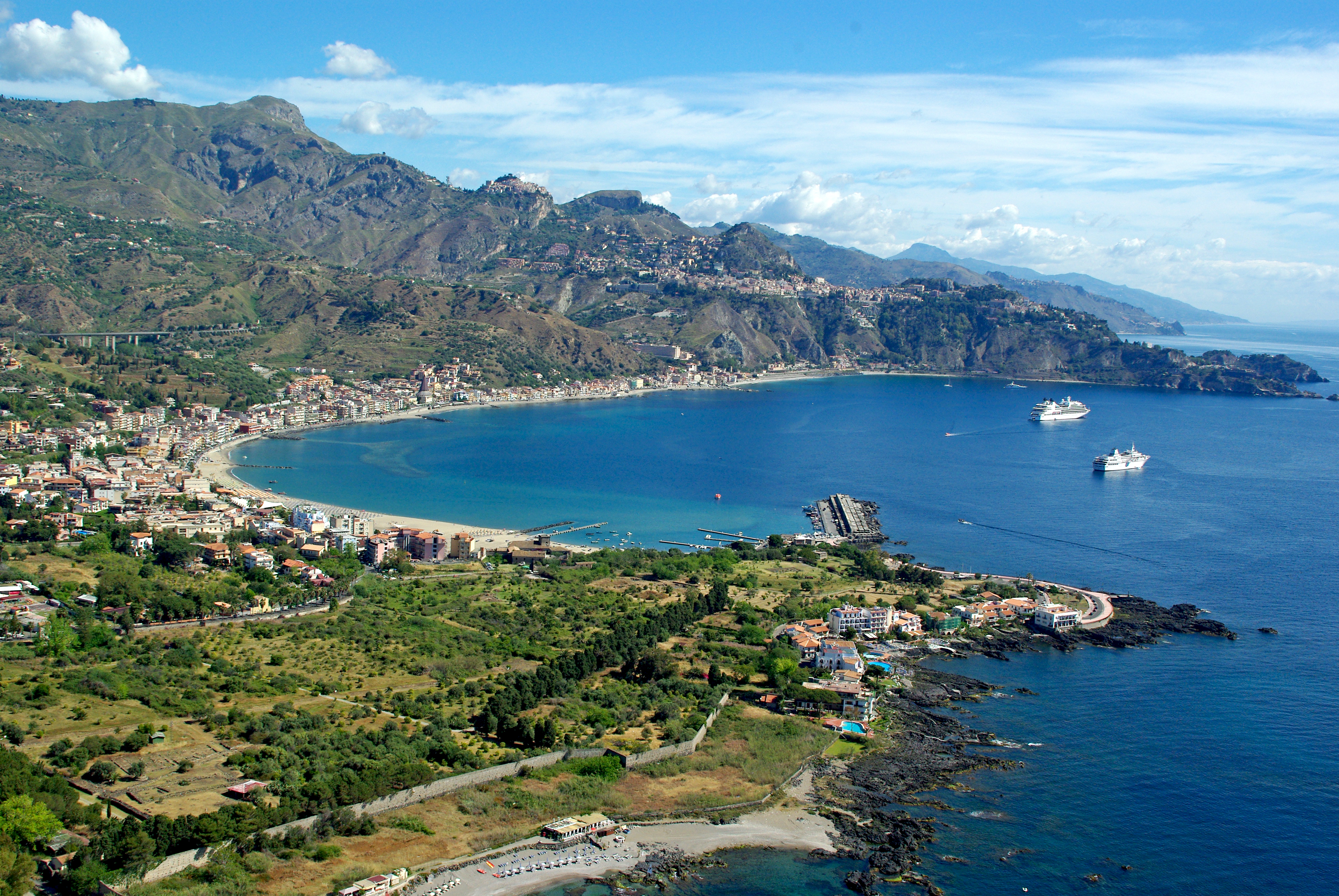 Giardini Naxos
 Oradea
 Kokkinopilos
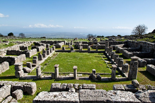
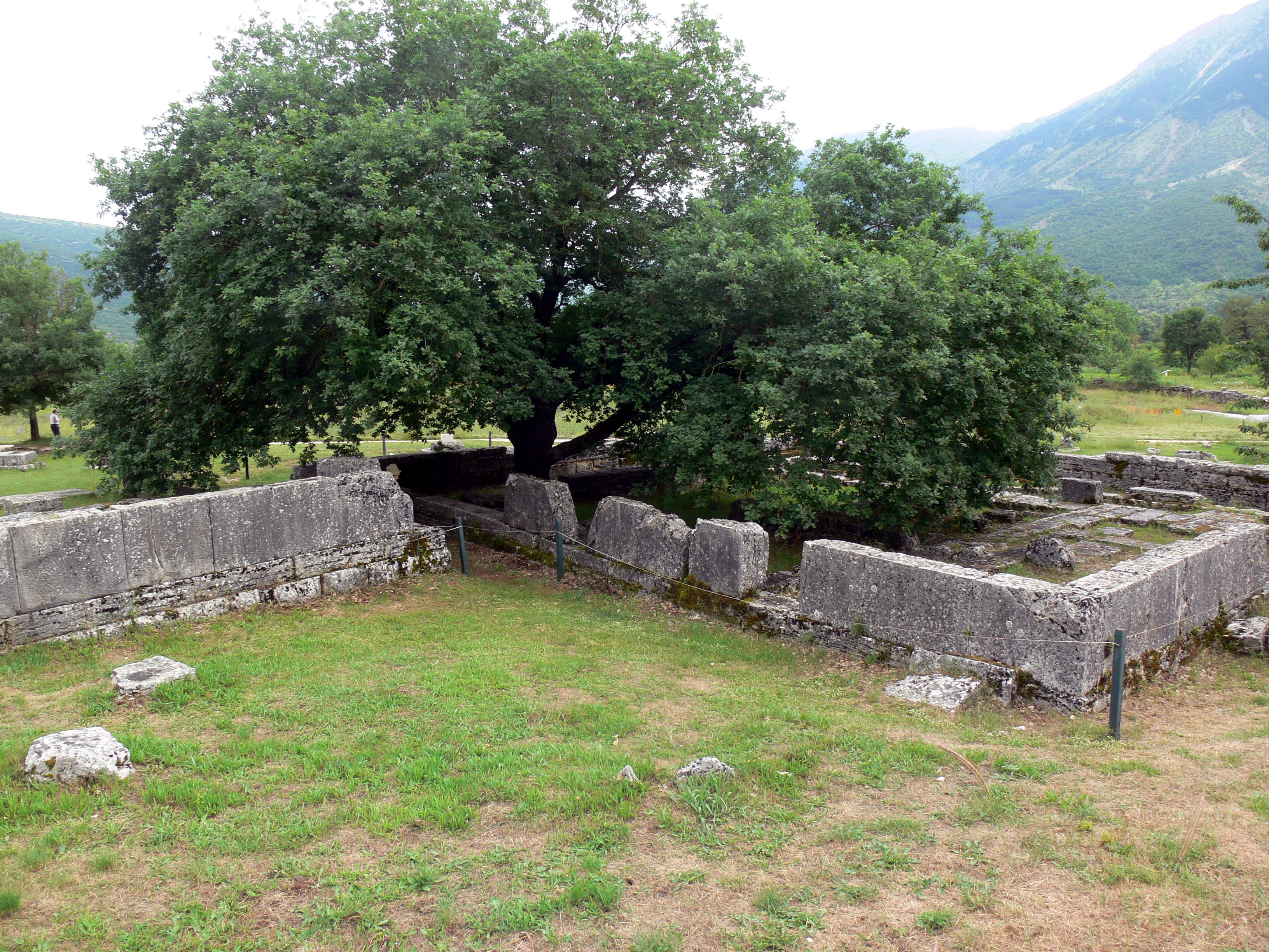
Archaeological Site of Dodona
The ancient site of Dodonais located 22 km. south of Ioannina, in the
narrow valley between the mounts Tomaros and Manoliassa. The first
remains on the site date from the prehistoric period and the first deity
worshipped here was the Earth goddess. The cult of Zeus and the sacred
oak tree was brought to Dodona by the Selloi, a branch of the
Thesprotian tribe, between the 19th and 14th centuries B.C. and soon
became the prevalent cult of the sanctuary.The first offerings from southern Greece date from the end of the 8th century B.C. and building activity began in the 4th century B.C. The sanctuary reached the highest point of its prosperity in the 3rd century B.C. but was destroyed by the Aetolians in 219 B.C. It was rebuilt shortly thereafter and continued to be in use until its destruction by the Roman invaders in 167 B.C. In the Roman period it had a different function and its end came in the 4th century A.D., during the reign of Theodosius the Great. The area of the sanctuary was then covered with Christian basilicas. Today the theatre is used for performances.
The first excavations on the site, carried out by N. Karapanos in 1873-75, confirmed the location of the sanctuary and revealed a great quantity of finds. The following excavation campaign was undertaken shortly after 1913, by the Archaeological Society, under the direction of G. Soteriades but was stopped by the events of 1921. The site was again investigated by D. Evangelides in the period from 1929 until 1932 and in the 1950's under the direction of D. Evangelides and S. Dakaris. Since 1981 the Athens Archaeological Society commenced a new series of systematic excavations on the site with the financial support of the University of Ioannina.
Systematic restoration work in the theatre, the stadium, and other monuments of the site started in 1961 and was based on the study of the architect B. Charissis. The whole project was financed by the Archaeological Society and the Program for Public Investments.
-The Sacred House (temple of Zeus, Building E1). At least four architectural phases are distinguished in the building whose original form remains unknown. It seems that in the beginning it was an open space with bronze tripod cauldrons surrounding the sacred oak tree. The first temple was built in the early 4th century B.C. and was gradually enlarged and repaired in the 4th, 3rd and 2nd centuries B.C. The latest and better preserved building measures 20.80 x 19.20 m.
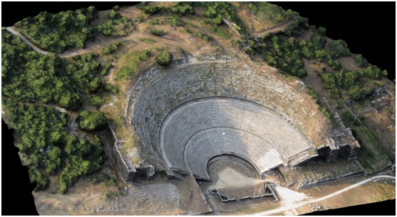
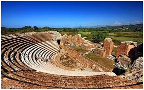
-The Theatre is one of the largest in Greece, seating 18.000 persons. It consists of the cavea (auditorium), the orchestra, a doric stoa and a wooden proscenium. It was built in the 3rd century B.C., during the reign of Pyrrhus, and was destroyed in 219 B.C. by the Aetolians. At the end of the 3rd century B.C. it was restored but was again demolished by Aemilius Paulus in 167 B.C. During the 1st century B.C. it was turned into an arena.
-The Bouleuterion(Building E2). The building comprises a large hall (measuring 43.60 x 32.35 m.) and a Doric stoa in the front. It was erected at the end of the 4th or the beginning of the 3rd century B.C. and was rebuilt twice, after its destruction by the Aetolians in 219 B.C., and by the Romans in 167 B.C. It was again repaired by Augustus and remained in use until the end of the 1st century B.C.
- The Stadium. The monument is not completely excavated. It is one of the few ancient stadiums with stone seats (21 or 22 rows of benches), contemporary with the second architectural phase of the theatre (late 3rd century B.C.).
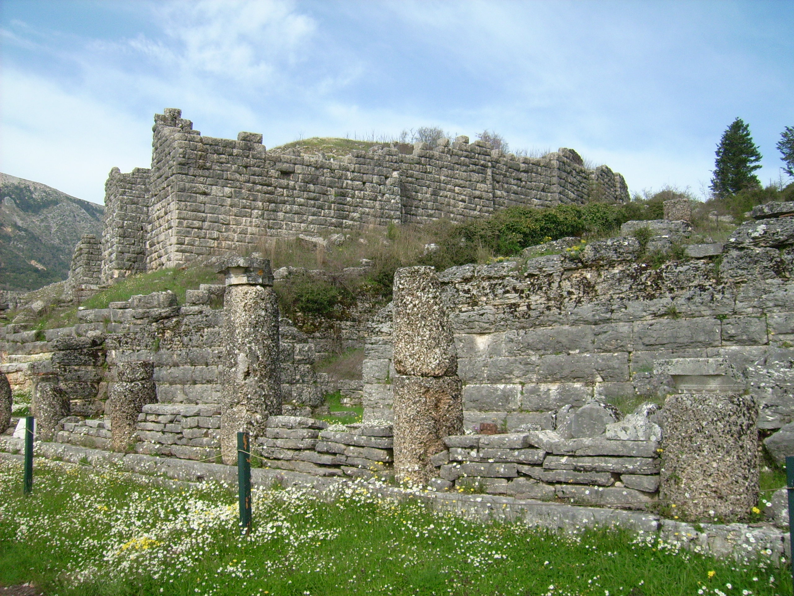
-The Acropolis. It occupies the top of the hill and is surrounded by a polygonal wall (750 m. long) dated to the 4th century B.C. The wall is reinforced with rectangular towers and has three main gates. Inside the walled area are preserved foundations of buildings and an underground water cistern, carved in the rock.
-The Prytaneum (Building H). Rectangular building (measuring 17.30 x 10.70 m.) dated to the 4th century B.C. It is the earliest structure of the sanctuary after the Sacred House. It functioned as a resting place for the priests of Zeus or the leaders of the Molossian Koinon (League) and was destroyed by the Aetolians in 219 B.C.
Roman Odeion of Nikopolis
The Roman Odeon, among the more
important and best preserved monuments in Nikopolis, is a true
architectural masterpiece by some unknown but great architect. It lies
at the centre of the town, on the west side of the Early Christian wall,
adjacent to the Roman agora (forum). It was used for lectures, literary
and musical contests and theatrical performances during the Nea Aktia
religious games honouring Apollo. Being adjacent to the agora, it
probably operated as a bouleuterion (council chamber) for the remaining
months of the year. It was built during the reign of Augustus (early
first century AD) and frequently repaired and remodelled in the late
second century - early third century AD.
The excavation of the monument is completed and extensive works were undertaken for the completion of the tiers, the cavea, the proscenium and the scene.
Roman Τheatre of Nikopolis
The theatre of Nikopolis is the first
monument observed by the visitor coming from the north. It lies in
Proasteio, at the north of the fortified city, to the southeast of the
monument of Augustus and to the east of the stadion. An impressive
construction erected in the early first century AD together with other
city buildings, it operated mainly during the religious celebration of
Nea Aktia in honour of Apollo. Lists of winners in the Nea Aktia
contests found in the temple of Apollo inform of competing poets,
sophists, comedians, heralds, trumpeters, guitarists, announcers, pipers
and mimes.
The theatre was built on the slope of a hill. In an effort to increase protection from earthquakes, a high buttressed wall was curved around the cavea. A wide corridor called diazoma divided the cavea into two sections, the main theatre and the epitheatro. At the corridor's ends were two large vaulted entrances. The outer protective wall had two stairways permitting spectators coming from the sanctuary of Apollo to access their seats. The cavea supported a peripheral portico probably sheltering spectators in case of a sudden storm. Only the pillars that propped up the roof remain of this gallery. The brick seats of the cavea were destroyed; the proedria (the first row of honour seats) was made of stone. Both the orchestra and the cavea were shaped as a regular semi-circle. There was a high, probably two-storey scene (characteristic of the Roman architecture) with three arched entrances at the fade, communicating with the logeio (the platform between the scene proper and the orchestra where actors performed).
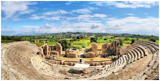
The theatre was built on the slope of a hill. In an effort to increase protection from earthquakes, a high buttressed wall was curved around the cavea. A wide corridor called diazoma divided the cavea into two sections, the main theatre and the epitheatro. At the corridor's ends were two large vaulted entrances. The outer protective wall had two stairways permitting spectators coming from the sanctuary of Apollo to access their seats. The cavea supported a peripheral portico probably sheltering spectators in case of a sudden storm. Only the pillars that propped up the roof remain of this gallery. The brick seats of the cavea were destroyed; the proedria (the first row of honour seats) was made of stone. Both the orchestra and the cavea were shaped as a regular semi-circle. There was a high, probably two-storey scene (characteristic of the Roman architecture) with three arched entrances at the fade, communicating with the logeio (the platform between the scene proper and the orchestra where actors performed).
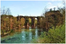
Roman aqueduct of Nikopolis
The aqueduct, 50 km. long, carried the water from the springs of
Louros to two cisterns in the Nymphaeum of Nikopolis. It actually
consists of three parts, each constucted in a different manner:- a channel with a vaulted, water-proof roof and ventilation shafts
- a tunnel quarried out in the Kokkinopelos valley and
- arcaded bridges that carried the water across the hills. - a channel with a vaulted, water-proof roof and ventilation shafts
- a tunnel quarried out in the Kokkinopelos valley and
- arcaded bridges that carried the water across the hills.
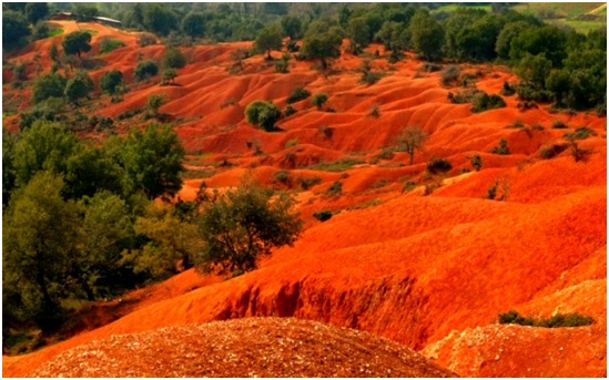
Kokkinopilos (Red Clay)
The area of Kokkinopilos Preveza is a
number of hills (height 100-150m) of geological and archaeological
interest. Not far from the village of Saint George and near the Louros
River, excavations unearthed the remains of a stone axe which may date
back to the Lower Paleolithic period as early as 250,000 BC. Researchers
believe that the location of the site near the Louros River and the
fertile plains surrounding it allowed early humans to flourish here.
Additional artefacts have been found from more recent periods suggesting
that the site was continually inhabited for more than 100,000 years.
Another intresting feature is the characteristic reddish tint of the
rocks and soil in the area as Kokkinopilos translates into “red clay”
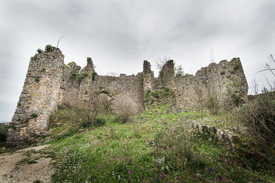
Ancient Vaties
Close to the village of Rizovouni of the prefecture of Preveza there was the ancient town of Vaties, which was a colony of Ileioi. It
was built on a hill and was surrounded by a polygonal wall, parts of it
are saved till today. Three gates and two doors are distinguished. It
had also internal walls. On the walls there are also roman extensions.

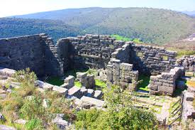
Ancient Cassope
Kassope or Cassope was an ancient Greek city in Epirus.Kassope occupies a magnificent and remote site on a high platform overlooking the sea, the Ambracian Gulf and the fertile lands to the south, and with the slopes of the Zalongo mountain to the north.
It is considered one of the best remaining examples of a city built on a rectilinear street grid of a Hippodamian plan in Greece.
The first settlements on the site are from the Paleolithic. However the city of Kassope was founded in the middle of the 4th century BC as the capital of the Kassopaeans, a sub-tribe of the Thesprotians. It belonged to the Aetolian League. The city flourished in the 3rd century BC, when large public buildings were built. Kassope also minted its own coins.
It was destroyed by Roman forces in 168-167 BC Kassope was abandoned in 31 B.C. when the remaining inhabitants resettled to Nikopolis the region’s new capital.
Souli
Souli is a historical and geographical area of Central Epirus,
which is a whole (referred to as a "federation") of villages [1] known
as Souliotochoria. It borders eastwards with Lakka Souli in the
prefecture of Ioannina and southwards with the villages of prefecture of
Preveza, while northwards and westwards it borders with the rest of
Thesprotia. It is located between the Murga Mountains (1,340 m.),
Zavrouchos (1,137 m), Tourlia (1,082 m.) and between Acheron with its
tributary Tsagariotiko. At the foot of the villages there are two
hills, Kugi and Kiafa(on which is the rock of Beira, which are important
from a geographic and historical point of view.The whole area of Souli is mountainous, steep, wild and according to the poet Andreas Kalvos, enchanting. It is reported that probably the first settlers in the area chose it because of its inaccessible and naturally fortified position.
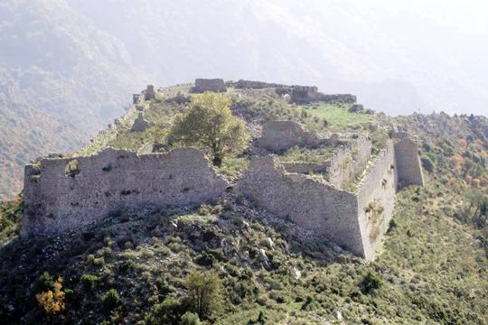
The castle of Rogon
Between the new Kerasoynta and Petra ,on a hill stands the castle of
Rogon. The castle was built on the ruins of the ancient city of
Voucheitio which was a colony of Ilion.The first fortifications on the
Acropolis of Rogon took place during the 5th century b.C. In the current structure of the castle are distinguished the boulders.The Romans in the 3rd century a.D. made the walls stronger and filled them. The 13th century is followed by the Byzantines, who gave to it the form it has today. Here, in 1304, was defeated by the Despot of Epirus, Tomas Phillip of Taranto who attempted to occupy the Despotate of Epirus.
Ancient Orraon
Ancient Orraon was founded and fortified between 385 and 370 B.C.,
when Alketas was the king of the Molossoi or, at the latest, in the
second quarter of the 4th century B.C. The settlement was destroyed by
the Romans in 167 B.C., was subsequently rebuilt and was finally
abandoned by its inhabitants who were obliged to settle in Nicopolis, a
city founded by Augustus after his victory in the battle of Actium, in
31 B.C.The most important monument of the site is the fortified city of ancient Molossia. Very characteristic are the narrow alleys of the settlement, the cisterns and the impressive fortification wall with the bastions, but also the absence of public places. All these features, in combination with the strategic position of the settlement, point to its defensive character.
Twelve narrow parallel streets, in a N-S direction, cross two wider streets, thus forming rectangular oblong insulae, 15 m. wide. The full width of each insula is usually occupied by a single house.
The private, stone-built houses of Orraon are exceptionally well preserved, sometimes even up to the upper storey, where the windows, and the door jambs and frames can be seen.
The first excavations on the site were carried out in 1972 by Ioulia Vokotopoulou, then director of the 12th Ephorate. In 1975, the University of Ioannina, under the direction of S. Dakaris, in collaboration with the German Archaeological Institute, started the excavation of House 1 in the ancient settlement, which was resumed in 1981.


No comments:
Post a Comment